When Persistence pays off
- Nair Fotografia
- Sep 24, 2020
- 16 min read

I am sure most of you who are reading this can relate to scratching an item off your bucket list. We all have bucket lists. Who doesnt have one ? If you dont have one, stop reading this blog, time to create one and then come back and continue.
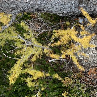
Ever since i moved to the beautiful Pacific Northwest, i have absolutely enjoyed the beautiful never ending summer hikes. A few years ago i learned about the magical Enchantments, a chain of alpine lakes tucked in at 6500 + ft elevation, where nature has carved one of the most magnificient places you will ever visit. There is no easy way to get here than hiking from one of the trailheads i.e. Colchuck Lake/Stuart Lake trailhead or SnowLakes trailhead. Keep in mind both trailheads are about 12 miles apart but the hiking trail through the Enchantments area can be anywhere from 23-30 miles depending on how much you venture out. A hike through the Enchantments is controlled by a lottery system. Hikers and backpackers apply for the lottery in early February at recreation.gov website hoping to get a day slot between May 31 and October 31 overnight use. The busiest months are summer and in October when the beautiful Larch trees change color to bright gold as you see in the above photo that i captured during my 4 day back packing trip to the Enchantments.
Permits for backpacking here allows for overnight camping at one of the five zones.
Core Enchantment Zone
Snow Lake Zone
Colchuck Lake Zone
Stuart Lake Zone
Eightmile/Caroline Zone

If you win a permit for the Core Zone you can overnight camp in any zone. If you win a permit for any other zone, you can only overnight camp in the zone you got permit for. Day use is permitted across all zones, but camping can only occur in the zone for which the overnight permit is issued.
A year ago me and my good friend Sanjeev where thinking of hiking to the Enchantments but we did not secure anything from the lottery that year so we gave up all hope that year. We decided to apply again in 2019 and after multiple people trying for the permit we got Stuart Lake Zone for first week of October and Core Zone for last week of October which is still dreadful considering how cold it gets and weather can be a nightmare some weeks in October with a lot of rain and definitely snow at these elevations. We decided to do the first week of October to Stuart Lake Zone.
Over the course of the next few months our group grew to a total of five people including a 14 year old (Sanjeev's son) ,who is a daredevil at hikes and snowboarding. I was also able to pull in my college buddy Satheesh from California for this hike. His plan was to drive up to Seattle ,stay with me a day or two and head out to this trip. Sanjeev also got one of his college friends Karthik for the trip. We created a whatsapp group for all to be in sync with the trip from February 2019 leading up to the trip in October 2019. The plan was to go to Stuart Lake and possibly HorseShoe Lake and come back in a 3 day window.
Although my plan was to do regular workouts to prep myself up to the backpacking trip, none of that was on routine considering how much i travelled the last year over 62000 airline miles. And as many may or may not know i went through two lobectomy surgeries in 2017 so my fitness has not always been the best since then. The feeling of executing a 4 day backpacking trip with 25-35 pounds of gear was slowly taking over my world of hope to complete this mission. As the days started getting closer the amount of outdoor gear i had to invest in to keep myself warm and safe out there kept growing and hence the weight. My camera (Canon 5dMk3) and a tripod along with my 16-35 mm lens was also adding so much to the weight which was another thing to consider. One should not carry more than 20-30% of your body weight when you backpack. You can see below the Osprey 65 L backpack which held well during this trip was about 27 lbs with all the gear including my tripod, sleeping pads, sleeping bags, food for a few days, camping stove, fuel and spare clothing. To help distribute the 3lbs of weight in the front of my body, i picked up a Cotton Carrier harness, which really helped with balancing the weight in the front and also help with ease of using the camera when you want to take a photo, with out having to open the bag each time and put it back securely in the harness, when you dont need it.
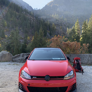
On the day of the hike, as we were approaching the Leavenworth area, Sanjeev and team who got their earlier secured a walk-in permit for the Core zone which was a dream come true experience. Although we had to pay 80 $ for five people all over again (keep in mind we already paid money for the Advanced Lottery system), it was still worth it as it was something we all have been dreaming off for over 2 years. But this also put a significant dent on our prep because now we may be looking at a four day backpacking trip when we originally prepped for three. Considering the snowy conditions at Colchuck Lake and Asgard pass , we decided to start the hike from the SnowLakes zone and see if we will make it through SnowLakes. This trail starts from the SnowLakes Zone 4 miles away from Leavenworth and was an easy drive to it.
DAY 1: Nada Lake
The trip started with a slow ascent from 2000ft at the trail head through beautiful forest and valley covered with fall colors everywhere.
The views along the way were very picturesque with many trees starting to change color. I guess fall is in the air :) Duh!! its October!!. We stopped for lunch break and refill water from a nearby stream. In many areas you could see so much frost accumulated already.Ran into so many mushroom growth all over the forest, for those mushroom fans, make sure you know what you are going to collect and eat before you jump in to harvest them :)
We stopped for a lunch break under some shade and used our first stash of freeze dried food and jetboil. Something to keep in mind as you climb to higher elevations, jetfoil takes longer to boil water, hence costing more fuel. Factor this into your jetfoil sizing before you start the trip in case many people are sharing one jetfoil fuel can.
After about 10 miles of hiking we finally reached our final stop for the day at Nada lake. Camping spots where non existent and/or almost all were taken. We were too tired to search for a spot after a long day of hiking and it was starting to get dark, so we decided to camp at a spot we thought was safe next to the lake without getting kicked out by a ranger for not camping at a designated spot. Fortunately we did not get into trouble at all :)
DAY2: Snowlakes and Lake Viviane
The following morning was a fun one, waking to 20 F and guess what , a guy (me) has to poop and there was no toilet anywhere in the vicinity :o. Rest of the gang all are snoring away and its bright and early 6.05 am in the morning. Your options in the wilderness are to carry a poop bag and carry it back out with you or dig a cat hole safely away from nearby water sources.
I sneak out of my tent and started scouting for a good location to execute, far away from the lake. Finally found a snow free spot and started digging and damn, the soil was hard as a rock. and my hands were freezing at this point. It is an experience trying to dig a hole when you have to go :)
Finally managed to dig a hole enough to perform the ritual and half way through the process, one of my friends woke up to pee and I was panicking to make sure he doesnt walk over to where I was :) . But in the end he went else where, peed and went back into the tent to sleep again. and a sigh of relief on my end and I continue on to finishing the ritual. Few minutes later , a happy camper and proud that I ever did my first cat style pooping and cleaning up, only to find out later from my friend, that there was an actual toilet not too far away and imagine my hate for my friend after hearing that news. He had conveniently forgot, to tell me the night before , about the toilet being nearby and I had to go through all that pain :(
Believe it or not these poop boxes they have installed in various campsites offer some of the best views you will ever have while executing. Trust me on this one, these toilets are the cleanest you will ever find. Just bring a sanitizing wipe to clean the lids but otherwise I have been very happy using them along the Enchantments trail.
After having breakfast and some jetboil French press coffee, believe me, when I say, I have to have good coffee in the morning before I can function, we decided to hike on to Snowlakes and further into the Core Zone. This was a difficult part of the hike too, as we were having to climb up further through many rocks and big boulders across the trail. Not a fun thing to do with 27 lbs of weight on your back.
Getting to Snow Lakes was a great relief as we were all needing water refills before we move on. The views at Snow lakes are magnificent, the water is so clear and freezing at the same time, keeping in mind you are at 5400 ft or higher at this point. There are two sets of Snow lakes known as Lower and Upper Snow lakes and you get to hike along the lake to the most part until you start diverting off into the forest and climb to higher elevations into the Core zone.
While hiking through the woods in this area, I lost my tripod from my backpack side pocket , it was secured but I guess it wasnt secured well enough. after hiking over a mile through the forest me and my buddy were stopped by a stream waterfall and another hiker passed by and asked us if we lost a tripod , which is when I started to panic. Luckily he had put the tripod on a rock where he found it, so all I had to do was trace back to the point and get it. Which I did but there goes some time off your hands and 2 miles of extra hiking which I didnt need on this day. Rule of thumb, make sure you have everything secured on your back pack before you move on from each rest stop you make.
The next section to hike up to the Core zone is a challenging one considering , yes you can get lost , some areas are not properly marked and its a constant uphill climb with all the backpack weight you are carrying. As you climb along the way you start noticing the beautiful larches changing color to yellow, which is the very reason most hikers come to this area in fall. We barely made it in time for sunset and found an excellent spot to camp right next to a larch tree at Lake Viviane. This is the point where you start to believe that this trip was so worth the effort coming here.
Trying to find a flat spot at this spot was almost impossible and with so much snow on the ground it was flat out freezing. Thanks to my two sleeping pads that I brought with me, helped increase the R rating to atleast 4.0 and keep me warm through the night. Although I did not sleep much that night, as I was too excited to take pictures of the starry clear night we had with the Temple (mountain range) against Lake Viviane. If you have never camped in a tent under the stars, that is an experience you should consider, because there is nothing like it.

It was a very windy night yet I decided to do some night shooting before I cave in for the night. I probably spent 3 hours in that cold weather shooting some star trails and pictures around the Viviane lake area. It felt magical to be around such beautiful atmosphere at night regardless of how cold it was. I just could not think of myself sleeping through such a beautiful night. Here are some pictures I shot at night from the area.


About three hours In, the rest of the gang had already slept, I just could not handle the cold any more, so I decided to wrap and crash for the night. I was not satisfied yet, but I didnt have a choice but to keep my fingers warm and not get a frost bite.
We woke up to a low 30s outside, but to some magnificent colors in the sky with so much drama from dark clouds moving in. It looked amazingly ominous. After capturing some sunrise photographs, we decided to move on to do our morning rituals. This spot at Lake Viviane has one of the worlds best rated toilets with a view. Trust me when I say this again, this is probably one spot that you do not want to miss on pooping :) what a magnificent view you get while sitting on that throne. Just make sure you dont have other hikers run into you while you are on the throne. I was happy camper to have found this particular spot :)
Day 3: Enchantments Core Zone and Aasgard Pass
After having another breakfast and coffee, we moved on from Viviane to the remaining lakes which includes Leprechaun Lake, Perfection Lake, Inspiration lake, Isolation Lake and Crystal Lake. One of the major hurdles here is the climb up on a rock fitted with rebars so that you dont fall. Most times these rocks are very slippery and these rebars are on there for a reason. It was a challenge for me at least to climb up these with 27 lbs on the back but something to keep in mind to have shoes that have a good grip , so that you dont fall down these rocks without sliding down and hurting yourself.
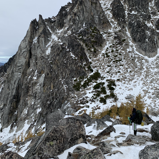
As you move on into the Core zone, it is hard to keep your hands away from your camera. Every where you look you will see just pure gold appearing as larch trees with gorgeous mountains and lakes all around. Some of the most beautiful mountains to be mentioned here are Mt. Prusik and Little Annapurna. Weather wasnt very friendly while we were here and it was very windy which did not help with any reflections of these mountains on any lakes or tarns. And most importantly we missed going to the famous Gnome tarn. I guess I will have to leave this spot for my next visit to this area. Something to look forward to. A short hike would also let you climb up Little Annapurna which gives some amazing views of the Enchantments from that vantage point.
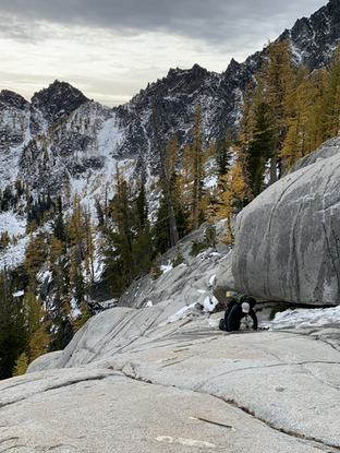
Just keep in mind , there can be so much snow even in early October , that you may want to carry crampons or micro spikes and wear them as needed, in many spots we found it very hard to get traction on our feet with the basic Yatrax that we were carrying. I really recommend getting something like a HillSound Crampon or similar for this hike, as you never know when you will need it, especially at Colchuck pass.
I still have not processed 80% of the photos from 2019 trip to enchantments, but as I am writing through this blog, I was looking through the photos I captured even on my iPhone looked pretty phenomenal. I cant wait to come back here for a summer trip to see what this place looks like In summer. But in all good sense, fall is the best time to visit here as it is not as hot and there are no bugs :)
After a strenuous hike with tons of photography through the various lakes I mentioned earlier, we finally got to the descent into Colchuck Lake and decided to take a quick stop, enjoy the view before we start going down through Aasgard pass. This is one of the worst hikes going downhill if you dont have good traction on your feet. I did glissade down a few spots just because my feet was just not getting enough grip, but be careful if you decide to do this , as many people have died here doing this same thing glissading down hill. Keep in mind there are tons of larch trees and boulders in this area that could be in your way the you slide down.
Keep in mind from this vantage point, before you start descending, it is somewhat deceiving as to how close Lake Colchuck looks from this point and believe it or not it is only less than a mile away and it should be easy, but if you are not experienced enough navigating through here and if you dont have the right technical gear such as crampons or spikes, it can slow you down signficantly. The spikes I had was not really helping as much, it was not the right kind, lesson learnt the hard way. Some of my friends were a little ahead of us and me and my buddy Satheesh got split from the pack as we were slowed down significantly with no traction on our feet. It was starting to get late and October sunsets are as late as 6.30 pm in the area. I believe the last 1/2 mile we had to navigate ourselves down in the dark with a flash light and using the Cairns (stack pile of rocks) that you can find every few 100 ft , which helps hikers to stay on the trail on this pass, as there is no real trail, you just have to figure it out yourself. The picture below shows an example of Cairns along the way that help you navigate and stay on track.

So lesson learned from all this , is to carry the right gear and try to climb up or down this pass during day time and not when you are losing light.
We managed to regroup with the pack, couple of hours later and it was already night time and we still had to maneuver ourselves around the lake to the camp grounds and find a camping spot for the night. Maneuvering around the lake can be quite challenging if you dont know your way around or in the dark, as you do have to climb quiet a series of large boulders and we got lost in the middle of the night until we finally were able to correct ourselves and find the right track into the camping spot trail. Key thing to note here is also not to panic in a situation like this, as that is not going to get you anywhere.
We finally where able to find a camping spot for 3 tents for the five of us around midnight when it started raining. Whew...what an eventful day we had that day to finally come to a spot where we could finally rest and then Mother Nature had to be kind up on us to start raining and drenching our tents in rain, but hey at this point, we just did not care, but to crash for the night.
Day 4 : Colchuck Lake and home
morning was the last day and we were welcomed with dark cloudy skies but atleast it was dry yet cold as F .This was also the day we had to exit the Enchantments area as our permit was only for four days. We still had about 6 miles down from Colchuck back to the parking lot , so we decided to grab some photos and breakfast before we go. Colchuck is one lake that never disappoints you on any given day, whether the weather is good or bad.
As we were hiking along the lake, we could see Aasgard pass and Dragontail peak which we suffered descending the previous night and just couldn't believe what we went through the previous night.But it was totally worth the experience, just wished that we had better gear and time in our hands during the day time.
After spending some decent time shooting pictures here at Colchuck Lake, we decided to do the final descend back to parking lot. There were many beautiful vantage points where we stopped for photos but in general this part is the most boring part of the trip compared to where we came from. Keep in mind also that most hikers who are smart does the Enchantments hike from Colchuck Lake up through Aasgard pass and into Enchantments core and then to Snowlakes and get out. We were the most dumbest hikers to do this hike the opposite route starting at Snowlakes and back out through Colchuck Lake. Regardless it has been an eye. opening experience with such beautiful views that I never imagined I would get to see, considering the two lung surgeries that I went through put a big impact on my breathing and fitness. But I am glad to finally have tracked 27 miles of this area (atleast what my phone was tracking) which is a huge first step for me with my fitness and hiking adventures.

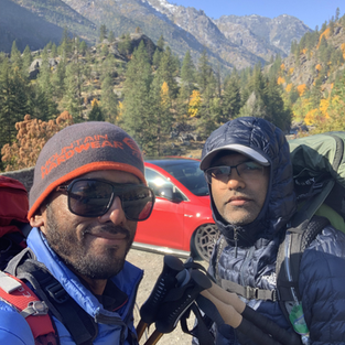
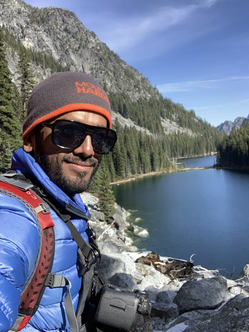
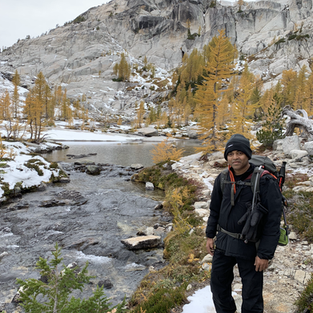
A few happy campers from this trip are highlighted below, as tired as F as we look, we were happy we finally did the Enchantments hike. I think over all we made a great team between myself, Sanjeev, his son Adu, Sanjeev's friend Keech and my college friend Satheesh. Looking forward to doing more hikes like this with the group in the near future.
When we finally made it to the parking lot, we realized that we still need to hitch a ride back to Snow lakes trail head parking lot where our cars were still parked at. We asked a few people who were leaving the parking lot, for a ride back to snow lakes trail head which is on their way back to Leavenworth. Most were reluctant, may be it was my scary look. Then two girls were about to leave and I asked them for a ride, first they agreed and then they changed their mind. May be , they thought I was a serial killer. Regardless of all these disappointments, finally a group were kind enough to ride me back to the parking lot, so I could get our car and come pick up our bunch. Whew what a relief.
The icing on the cake for hiking the Enchantments is that, when you are back, you get to drink your favorite beer Irish Death and that too a liter of it and eat some Currywurst. Best damn meal I have touched in four days.
In the end we gained around 6760 ft in various parts of the hike and an elevation loss of 4897 ft. Those are some thigh burning work outs :). "I dont think I ever want to do this again", as I always say, after a difficult hike that kicks my arse , but that holds true only until next time :)
Some closing thoughts as I am sure you all are bored reading my mumbo jumbo, I think this is one of the best backpacking trips I have experienced and one should think of putting this in your bucket list if you want to get out of your busy life and experience the vast beauty of Mother Nature in the raw. Especially if you are a photographer, you will never stand still when you hike through this place. Make sure you bring enough batteries for your camera and some booze to keep you warm in the night :). I hope to do this hike here again soon, but until then, my fingers are tired, typing up this story. I hope you enjoyed it as much as I did writing this up, and please leave any comments or thoughts you may have about this article.
















Comments